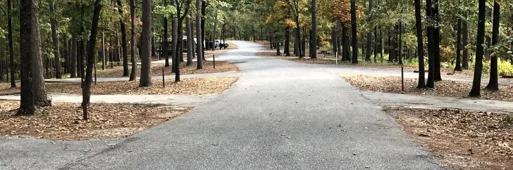
Photo: USACE
About this campground
Iron Mountain Campground sits on the southern banks of DeGray Lake in the foothills of the Quachita Mountains.
Around here
Around Iron Mountain
69 campsites at their real positions. The 69 with power are yellow. Tap a site for its hookups and rig length.
Loading map…
Temperature from a 1980 federal survey. The record says nothing about access, ownership or current conditions.
- An Overview: West Mountain TrailsHiking · 40-240 Minutes19.7 mi (opens in a new tab)
- Sunset TrailHiking · 6-9 Hours19.7 mi (opens in a new tab)
- Grand Promenade National Recreation TrailHiking · 30-60 Minutes20.1 mi (opens in a new tab)
- West Mountain TrailHiking · 30-60 Minutes20.1 mi (opens in a new tab)
Data Source: Recreation.gov · Source: USGS GNIS · Thermal springs: NOAA NCEI (1980) · Source: National Park Service. No claim to original U.S. Government works. · Public land: USGS PAD-US · Forest roads: USDA Forest Service MVUM · BLM routes and areas: Bureau of Land Management (simplified for web display)
Sites and hookups
- Campsites
- 69
- Sites by type
- 39 RV
- Electric hookups
- 68 sites, up to 50 amp
- Water hookups
- 1
- Max RV length
- 70+ ft
- Pull-through sites
- 3
- Pets
- Allowed
- Campfires
- Allowed
- Booking
- Reservable on Recreation.gov
Amenities
- Showers
- Flush toilets
- Playground