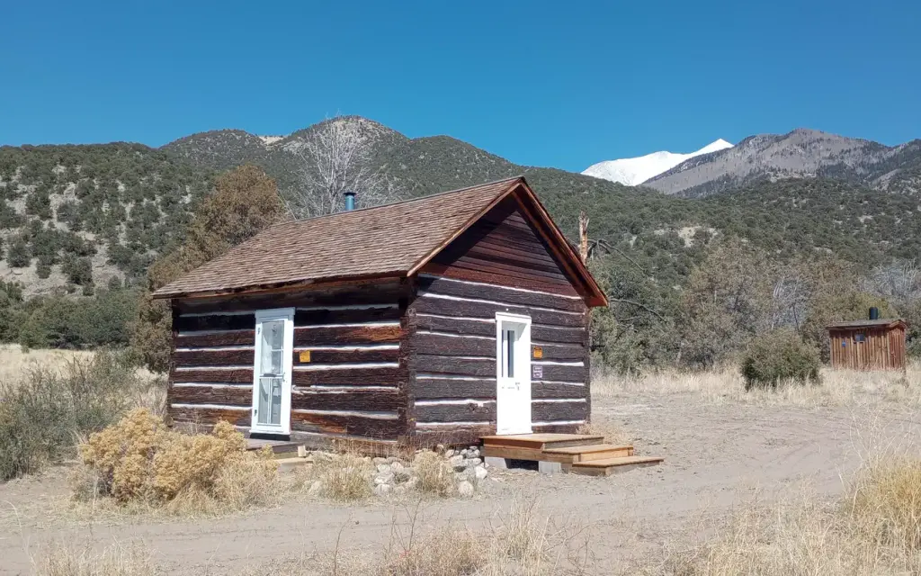
Photo: Rio Grande National Forest, Saguache Ranger District
About this cabin rental
The cabin was constructed in the 1880s. The cabin sits 8,120 feet above sea level beside a small dry stream‐bed. The nearest source of water is Pole Creek which is approximately 1,500 feet from the cabin. The cabin sits on a west‐facing gently sloping grade that looks out onto the San Luis Valley.
Around here
Around Duncan Cabin
Loading map…
Temperature from a 1980 federal survey. The record says nothing about access, ownership or current conditions.
- Hike Sand Creek LakesBackcountry Hiking · 10-15 Hours6 mi (opens in a new tab)
- Hike Medano Lake and Mount HerardBackcountry Hiking · 8-12 Hours6.7 mi (opens in a new tab)
- Explore the DunesFront-Country Hiking10.1 mi (opens in a new tab)
- Experience the NightStargazing · 30-300 Minutes10.6 mi (opens in a new tab)
Data Source: Recreation.gov · Source: USGS GNIS · Thermal springs: NOAA NCEI (1980) · Source: National Park Service. No claim to original U.S. Government works. · Public land: USGS PAD-US · Forest roads: USDA Forest Service MVUM · BLM routes and areas: Bureau of Land Management (simplified for web display)
Sites and hookups
- Sites by type
- 1 cabin
- Walk-in sites
- 1
- Pets
- Allowed
- Campfires
- Allowed
- Booking
- Reservable on Recreation.gov
Amenities
- Vault toilets
- Cell service