Utah
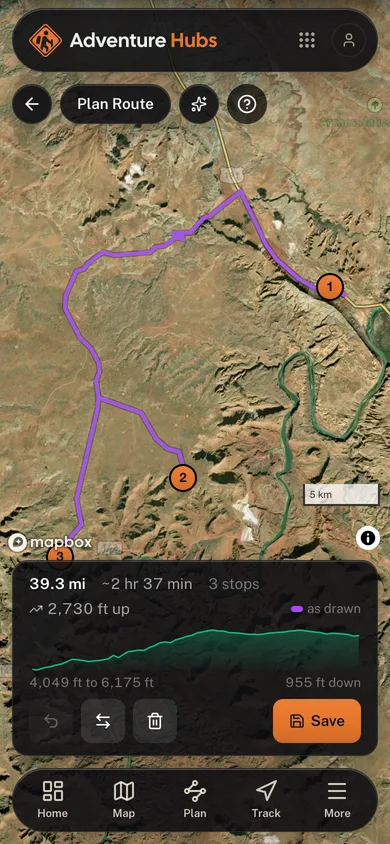
Moab Parks Loop
Around here
Around Moab Parks Loop
Before you go
Data Source: Recreation.gov · Source: USGS GNIS · Source: National Park Service. No claim to original U.S. Government works. · Public land: USGS PAD-US · Forest roads: USDA Forest Service MVUM · BLM routes and areas: Bureau of Land Management (simplified for web display)
About this adventure route
Moab sits between two national parks and a state park that would be a national park anywhere else, and this loop connects all three in a day of driving with short hikes at each. Arches in the morning, Dead Horse Point at midday, Island in the Sky in the afternoon. The three overlook different pieces of the same canyon system, so the day builds rather than repeats.
A red-rock road trip linking Arches, Dead Horse Point, and the Island in the Sky.
Highlights
What earns the trip
- Delicate Arch and the Windows section at Arches
- Dead Horse Point overlooks a 2,000 foot gooseneck of the Colorado
- Island in the Sky sits on a mesa above the White Rim
- All three are within an hour of Moab
Stops
- 1
Arches National Park
Park entrance, five miles north of Moab.
- 2
Dead Horse Point
State park overlook above the Colorado River gooseneck.
- 3
Island in the Sky (Canyonlands)
The mesa-top district of Canyonlands.
When to go
Best time to go
March through May and September through October. Midsummer regularly exceeds 100F.
Planner estimate for the mapped line: 2h 40m
Before you go
Know before you go
- Arches uses a timed entry reservation system during peak season.
- There is no water on the Island in the Sky mesa beyond the visitor center.
- Slickrock gets dangerously hot and slick. Hike early and wear real shoes.
More adventure routes
Browse all routes